If you are interested in the structures of the Rigi, you will almost inevitably end up with the hotel palaces: with the ruins on the Scheidegg, with the demolished boxes in Kaltbad, with everything that was once grandly conceived and then torn down. The thesis of this text is different, and it is to be read as an evaluation: The most technically interesting preserved structure on the mountain is none of these hotels, but an approximately 50-meter-long iron bridge near Unterstetten, which was considered in need of renovation in 2013 and is now part of a hiking trail marketed as barrier-free.

A gaping crack in the northern abutment
The findings, with which the story begins, come from the dossier of the Gesellschaft für Ingenieurbaukunst on the hiking trail over the old Rigi route. The iron structure itself was generally rated as good at the time. At the northern abutment, however, the masonry below the bearing bank was heavily bulging, and a gaping vertical crack indicated that the abutment wall had shifted. A provisional shoring supported the last field, the end of the bridge hovered over the sunken bearing bank.
The specialist article “From railway line to high-altitude trail” in espazium names the cause: water seeping behind the masonry pier. It also states that the shoring had been in place for about six years at the time of publication — the article appeared in April 2015, so the temporary structure dated back to approximately 2009.
One detail is regularly misrepresented in stories about these years, namely that the bridge was closed due to the risk of collapse. The Ingenieurbaukunst dossier explicitly states that a temporary wooden bridge allowed access and hikers could continue to use the bridge. Already a report in the Luzerner Zeitung about the crack formation — it describes the structure as 134 years old and thus dates it to 2008 — quotes Karl Küttel from Rigi Scheidegg AG stating that the bridge was never closed to hikers. Alpine traffic was temporarily closed, not the footpath.
A railway as a hotel feeder
The bridge stands there because a hotel needed a feeder. The Regina Montium company, founded in Olten in 1873, wanted to participate in the Rigi tourism triggered by the Vitznau-Rigi-Bahn. It built a new hotel on Rigi First and bought the existing houses on Rigi Kulm and Scheidegg. To ensure that guests could easily reach the Grand Hotel Scheidegg from Rigi Kaltbad station, the Rigi-Scheidegg-Bahn was built. According to the Wikipedia description of the Rigi-Kaltbad-Scheidegg-Bahn, the construction was awarded to the Internationale Gesellschaft für Bergbahnen from Aarau at a fixed price of 1.35 million francs; in the end, it cost 1.6 million.
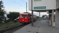
The concession for a panoramic railway from Kaltbad to Scheidegg was granted by the federal councils, according to the Kulturspur Rigi of the municipality of Arth, as early as 1872, one year after the completion of the Vitznau-Rigi-Bahn. Construction took place in two stages because the engineering structures required time: On July 14, 1874, the Kaltbad–First–Unterstetten section went into operation, followed by the Unterstetten–Scheidegg section on June 1, 1875. The railway was meter-gauge, 6747 meters long, and had a maximum gradient of 50 per mille. It was a pure adhesion railway without a rack, the second narrow-gauge railway in Switzerland, and remained unelectrified as one of the few private railways until the end. According to the municipality of Arth, the First station was the first railway stop in the canton of Schwyz — a point that is consistent with the often-heard statement that the Arth-Rigi-Bahn, opened in 1875, was the first railway line entirely within the canton of Schwyz.
The construction was particularly challenging geologically. The municipality of Arth mentions extensive earth and rock work and the securing of the terrain where marl layers are embedded between the Nagelfluh banks, at the Dossen and Allenwindentobel.
Four fields, two plate girders
The construction is unusually simple and worth reading from the boundary conditions. According to the Ingenieurbaukunst dossier, the support system is a continuous girder over four fields of 12.5 meters each, made of riveted iron construction, supported on three internal piers of iron construction and two abutment piers of natural stone masonry. The superstructure consists of two riveted plate girders of constant height of 1.04 meters, connected by a lower horizontal wind bracing and by cross girders made of diagonal crosses. In the longitudinal direction, the girder beam slopes from south to north at 50 per mille — the same inclination that was also the maximum gradient of the railway.
Why plate girder and not truss: A truss girder saves material, but costs working hours for many nodes. With a span of 12.5 meters, the material saving is too small to justify the additional effort. The Ingenieurbaukunst dossier states exactly that: The plate girder was the logical solution for the relatively small spans, a truss construction would only have been economical for larger spans. As a result, construction costs and construction time are low, which was important for a railway that was supposed to be completed as quickly as possible as a feeder.
More interesting is the second derivation. The bridge is curved — the smallest curve radius of the railway was 105 meters according to the route documentation on eingestellte-bahnen.ch, and the girder beam runs polygonally in plan with a radius between 105 and 120 meters. A curved girder is not only bent under vertical load, but also twisted: The resultant of the support forces no longer runs in the girder plane, torsion occurs. Two parallel girders alone could not absorb this. However, because they are connected at the bottom by the wind bracing and transversely by the diagonal crosses to form a closed cross-section, the whole thing acts statically like a stiff box girder that absorbs bending and torsional stresses, according to the dossier. The curvature, which at first glance looks like an additional difficulty, thus becomes a component that contributes to the stiffness.
One hundred meters opening, fifty meters bridge
The figures for the bridge contradict each other in popular representations, and the resolution is also in the Ingenieurbaukunst dossier. The bridge crosses an opening of a mountain ridge about 100 meters wide. However, it is only about 50 meters long itself, because the access on both sides is via earth embankments that are piled up against the abutment piers. The embankments reduce the actual bridge length. Four fields of 12.5 meters each result in exactly these approximately 50 meters, and the Wikipedia representation as well as the municipality of Arth independently speak of an iron bridge of 50 meters in length.
Accuracy is also worthwhile for the height. The dossier describes the three internal piers as approximately 8-meter-high truss constructions, placed on natural stone masonry plinths, whose height varies depending on the longitudinal slope. It does not state an overall height of the structure above ground. Tourist sources such as the hiking description by Famigros state a height of approximately 15 meters. This is not a direct contradiction: The 8 meters refer to the iron part of the piers, the 15 meters apparently to the entire height including the plinth. The Rigi Anzeiger also mentioned a height of 15 meters in 2013; the article itself could not be viewed, and whether it referred to the piers or the entire structure is open. As a pier height, the number would certainly be misleading.
Wrought iron, not steel
According to the Ingenieurbaukunst dossier, the iron construction, like similar constructions of that time, was made of wrought iron, not steel in today's sense. This is not nitpicking, but determines what can be done with the structure. Wrought iron is a malleable iron with a very low carbon content, which was rolled out in a pasty state and retains slag embedded in rows. This row structure makes the material tough in the rolling direction, significantly less so transversely, and it is the reason why fusion welding on such components is tricky. That is why riveting was used at that time, and that is why riveting or screwing remains the obvious type of connection even during repair. The builder of the railway line and its engineering structures was Niklaus Riggenbach, the iron construction company involved was Maschinenfabrik Aarau.
Concrete slab on iron girder
The end of operations is well documented, yet inconsistently dated. Wikipedia and eingestellte-bahnen.ch state September 21, 1931, while the Ingenieurbaukunst dossier and the espazium article state September 20, 1931. It is undisputed that the railway subsequently sold its rolling stock and the rails were dismantled in 1942. The economic basis was gone by this time: in 1930, the railway still transported 12,834 people during summer operations.
The owner then had a concrete slab placed on the iron structure, making the bridge usable for hikers and single-lane agricultural traffic. From a monument preservation perspective, this intervention is ambivalent, and the Ingenieurbaukunst dossier also states this: The riveted construction, despite the strong plate girder, appeared filigree, especially in its time as a railway bridge; with the construction of the concrete slab including a somewhat massive curb, the bridge lost some of this boldness. On the other hand, precisely this intervention kept it usable — no use without a roadway, hardly any reason for maintenance without use.
What happened between 2013 and 2017
First, the track was repaired, not the bridge. The espazium article describes the work from 2013 to 2015 in cooperation with the cantonal office for forest and natural hazards, the Federal Roads Office, and the cantonal monument preservation. Priority was given to surface drainage: The path received a continuous unilateral cross slope of 5 percent, the uppermost 5 to 10 centimeters were torn open, broken on site with a mobile stone crusher, and enriched with Nagelfluh from the surrounding area. Espazium estimates the costs for the panoramic path at 1 million francs, financed by Rigi Scheidegg AG, Rigi Bahnen AG, Astra, the hiking trail specialist office, the monument preservation of the canton of Schwyz, and the Unterallmeind-Korporation Arth. The 1.1 million mentioned in the proposal could not be substantiated.
An often underestimated part of the work was the clearing of trees. Trees up to 30 meters high had rooted through embankments and abutments along the route; their removal was, according to espazium, a significant contribution to the preservation of the substance — and incidentally improved the view.
For the Rothenflue and Schild bridges, both single-span girders, the principle remained the same: load-bearing concrete slabs on historical riveted iron girders. Because the structures have been in the cantonal inventory of protected buildings since 2013, it was important to the monument preservation that the girders remain visible after the renovation. The old slabs with a roadway width of 2.3 meters were replaced by wider ones, 3.4 meters for Rothenflue and 3.2 meters for Schild. The concept for the interventions came from Eugen Brühwiler, professor at EPFL, who had prepared an expert opinion on the Unterstetten bridge in 2008 on behalf of the Federal Office of Culture.
The sources differ on when the Unterstetten bridge itself was renovated. Wikipedia states that the route and bridge were renovated between autumn 2013 and 2016. The espazium article from 2015, however, speaks of a separate project, whose costs would be somewhat higher and which should follow as the final point in 2015/2016. Tourism sites such as switzerland-highlights.com date the renovation of the "Eiffel Bridge" to 2017, initiated for the 50th anniversary of Rigi Scheidegg AG. Official confirmation of the completion year could not be found.
The status today
The route is listed in the inventory of historical transport routes in Switzerland as an object of national importance, and the Unterstetten bridge is a protected monument as a cultural asset of category B. According to espazium — based on the Rigi Anzeiger of October 2013 — the panoramic path records approximately a quarter of a million uses annually.
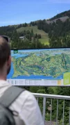
Today, it is marketed as the opposite of what the 2013 findings described. Rigi Bahnen promotes the panoramic trail as a seven-kilometer-long barrier-free high-altitude hiking trail that can also be used with strollers or walking aids; the tour description of the Schwyzer Wanderwege on luzern.com states for the Scheidegg–Kaltbad direction 6.26 kilometers, 1 hour 40 minutes, and the characteristic "barrier-free". The Ingenieurbaukunst dossier also states 7 kilometers and about two hours for the hike from Rigi Kaltbad; the railway took 40 minutes for the same route.
Scheidegg is accessed via the cable car from Kräbel. According to Rigi Bahnen, it was completely rebuilt in autumn 2017; SRF reported on December 22, 2017 on its commissioning. The system cost 6.4 million francs, has two cabins for 15 people each, transports up to 130 people per hour, and takes less than six minutes from Kräbel, located at 760 meters, to Scheidegg. A predecessor railway operated there since 1953.
The sources differ on the altitude of Scheidegg: SRF states 1640 meters, Wikipedia 1648 meters, the tour description on luzern.com 1656 meters, and eingestellte-bahnen.ch lists the former railway station at 1607 meters. The values refer partly to the summit, partly to stations at different locations; there is no uniform number.
Two further contradictions remain open. For the tunnel, Wikipedia, the municipality of Arth, and espazium state 70 meters, the Ingenieurbaukunst dossier 50 meters; the name also varies between Weissenegg Tunnel and Wisstannegg Tunnel. And the widespread statement that the railway was never profitable is not proven with such sharpness: The bankruptcy of January 22, 1878, the forced liquidation by the Federal Court, and the takeover by a new company on December 13, 1879, for 60,000 francs are documented. Whether individual operating years brought black figures could not be clarified based on the sources used.
Little of the rolling stock remained. Eingestellte-bahnen.ch lists two passenger cars sold in 1961, which stand as a holiday home in Unterstetten; Wikipedia lists car no. 7, which bore the number 5 before a conversion. The Rigi Anzeiger wrote in 2013 that a private individual had acquired one of these panoramic cars and that initials could be seen on the axles; this could not be independently substantiated — the route documentation does not mention a buyer for the cars sold in 1961.
Why this particular structure survived
The following conclusion is my own and is not found in any source. What is remarkable about the Unterstetten case is less the engineering achievement of 1874 than the constellation of stakeholders in 2013: a private mountain railway company, a railway company, a federal office, a cantonal monument preservation office, a hiking trail specialist office, and a corporation agreed on one million francs for an object that belongs to none of them alone and benefits none of them alone. This succeeded because the object already existed. One can argue about the preservation of an existing structure without anyone fundamentally opposing its existence; an agreement on a new construction project on the Rigi can hardly ever be reached in the same circle, as the decades-long debates about new facilities, visitor management, and second homes show.